Third Baseline Survey Set for Marine Environment Protection

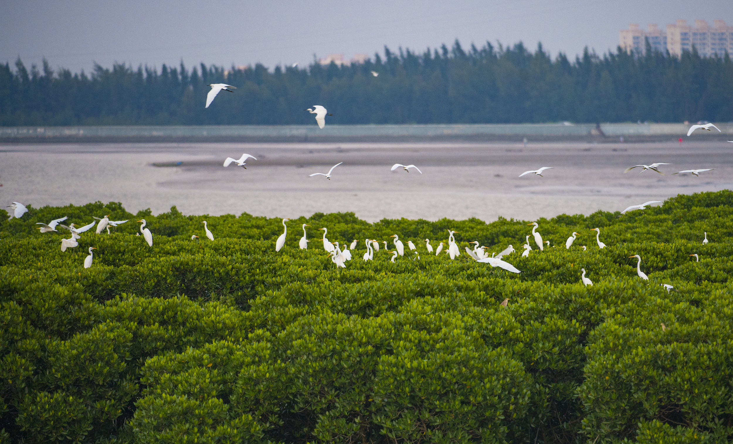
The Dongzhai Port National Nature Reserve, located in Meilan district of Haikou city, Hainan province, boasts a mangrove forest that provides a habitat for egrets. (PHOTO: VCG)
By CHEN Chunyou
China launched its third marine pollution baseline survey this May, set for completion in 2025, said Wang Juying, director of the National Marine Environmental Monitoring Center, at a press conference centered on the marine environment governance held by the Ministry of Ecology and Environment (MEE) on August 28.
This baseline survey aims to grasp the basic status of the marine ecological environment in a certain historical period. China conducted the first and second baseline surveys in 1976 and 1996 respectively.
"Compared with the previous two surveys, this year's survey focuses more on the coastal waters and the country's 283 bays that are most directly affected by human activities," said Wang, adding that a greater emphasis has been put on assessing the environmental pressure and ecological status of the coastline. To ensure the quality and efficiency of the data collection, multiple high-tech means such as remote sensing satellites and aerial filming are being used.
Currently, the primary sources of nitrogen and phosphorus in coastal seawater are inbound river waters, agricultural non-point source pollution, urban industrial wastewater and sewage discharge, mariculture, and marine atmospheric sedimentation.
To better manage these pollution sources and reduce the total nitrogen and total phosphorus discharge of rivers into the sea, Wang emphasized the need for stronger control over nitrogen and phosphorus pollution into the sea, the construction of more coastal urban sewage collection and treatment facilities, the implementation of differentiated measures to address agricultural non-point source pollution, and the launch of artificial wetland purification and ecological capacity expansion projects.
Another important area of marine environment concern is mangroves. These are groups of trees and shrubs that live in the coastal intertidal zone and their dense tangle of prop roots is key to stabilizing coastlines. Meanwhile, mangroves provide natural infrastructure to help protect nearby populated areas by reducing erosion and absorbing storm surge impacts during extreme weather events such as hurricanes. Furthermore, they play a vital role in regulating and mitigating the effects of climate change by sequestering substantial amounts of carbon.
China's mangrove area has increased to 438,000 mu (29,200 hectares), marking an increase of approximately 108,000 mu (7,200 hectares) compared to the early 20th century. This development has positioned China as one of the few countries globally to witness positive growth in mangrove coverage, according to Hu Songqin, deputy director general of the Department of Marine Ecology and Environment at MEE, adding that the ministry will intensify the protection of mangroves, and guide China's coastal regions to implement measures to restore mangrove trees in bay areas.
In addition, the health status assessment of mangrove ecosystems will be carried out regularly across the country, and mangroves will be incorporated into the scope for refined investigation in terms of the bay's ecological environment monitoring accordingly, said Hu.


